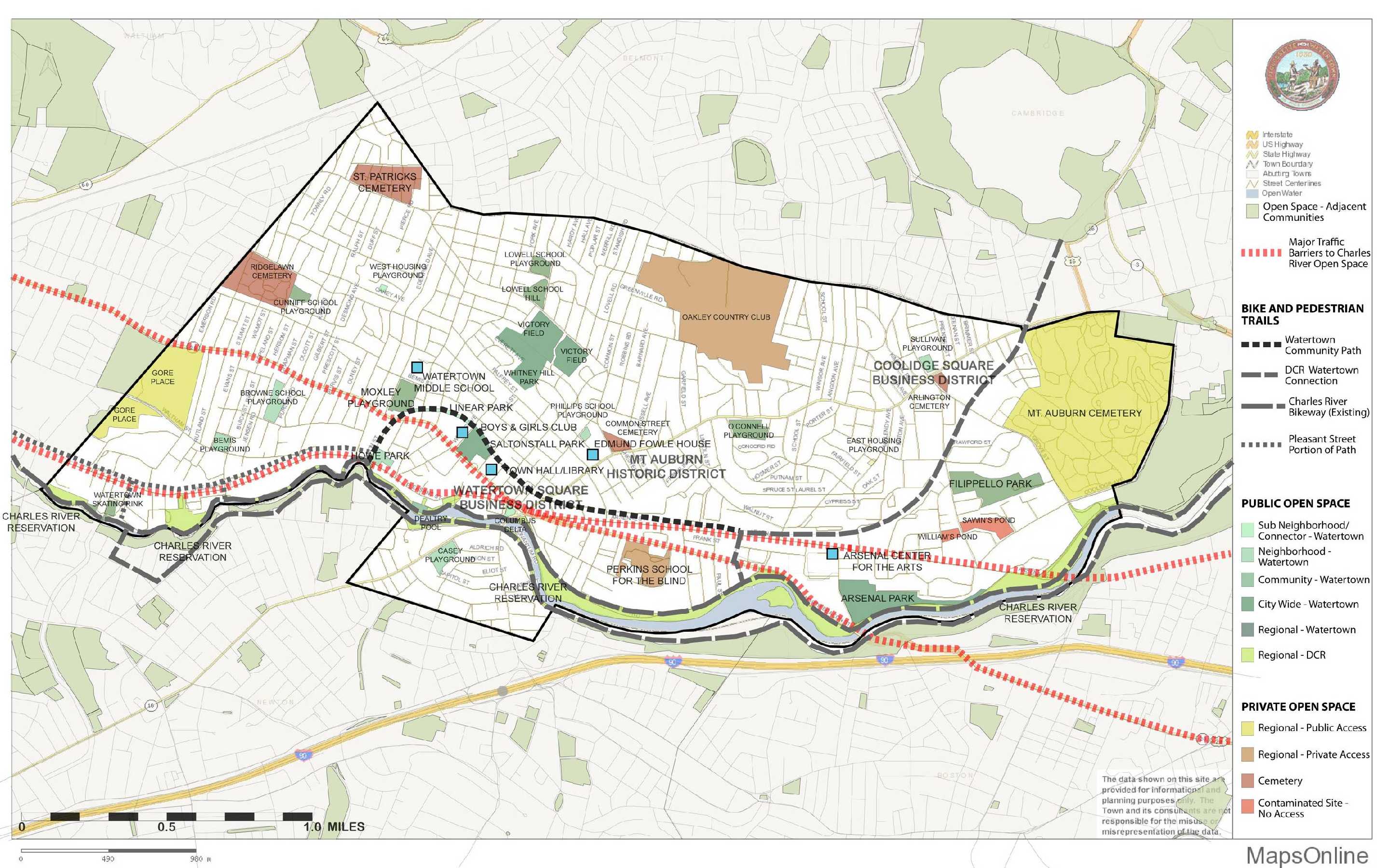
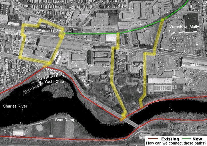
1/2010 News/Status: A 0.7 mile section of this trail, also called the Charles River - Alewife connector and the Watertown Community Path is 100% designed and should be constructed this year by the DCR for $847,000. It will go from Arlington St. to School St. and include a spur to Arsenal St. across from the mall.
Here are the 2009 Plans: http://watertownbikeped.org/pathdesign.html
This is one section of a longer potential rail trail on a line that ran from Cambridge to Waltham but is still active for some distance on both ends. The state of Massachusetts EOTC purchased the 1.3 mile section of old railbed from PanAm (Guilford/B&M)Transportation between School Street to Grove Street. It was transferred to the State Department of Conservation and Recreation with the intent of developing a multi-use trail for recreation and commuting. The project has enjoyed the backing of Senators Kennedy, Tolman and Tolman, among others.
Other sections of this rail line that have been sold off to abutters and possibly "lost". See http://watertownbikeped.org/maps/branch.html
North of the soon to be built section is the active section (one track is still used for occasional 3 mph flour deliveries down past Fresh Pond to Newlywed Bakery. In May 2005, Guilford Rail systems filed to abandon service (See Surface Transportation Board STB Docket AB 32 (Sub No. 98X) and AB 355 (Sub No. 32X)). The future status of rail service is in doubt, but there is potential for shared trail/rail use).
However, the City of Cambridge has built a multi-use path along part of this (barely) active line and then along city streets to reach Alewife Station
http://www.bikexprt.com/massfacil/cambridge/freshpond/sidepath.htm
Fresh pond map: http://www.cambridgema.gov/CityOfCambridge_Content/documents/Trail%20Width.pdf
To the west School street, the old route may be lost for trail development. However, the Charles River paths parallel this section, and provide a great potential link to Watertown Square for regional recreational use. However, this section of trail will reach its full potential only when connected to an existing trail. There are challenges in acomplishing this goal:
A blog about the latest (2009) plans: http://watertownbikeped.blogspot.com/2009/04/mass-highway-updates-plans-for-path.html
For more information please contact Peter Brooks of the Watertown Trail Committee. There are volunteer opportunities available to make this all happen for the benefit of Watertown and the entire Boston region!
Want to armchair travel on the line? Try the pages of Paul Eestin or Vanshnookenraggen.
This project was first identified in a major planning study in 1996, as part of the "Minuteman Bikeway-Charles River Connector Feasibility Study, March 1996" by the Central Transportation Planning Staff (CTPS).
![]() Last update: August 2005 1998 Status Update home page.
Last update: August 2005 1998 Status Update home page.